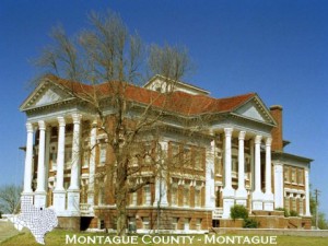
MONTAGUE COUNTY is in the northern part of north-central Texas. It is bordered on the north by the Red River and by the State of Oklahoma. Its total area is 599,680 acres, or 937 square miles.
Montague County is in the North Central Prairie, the West Cross Timbers, and the Grand Prairie Land Resource Areas. The soils of the North Central Prairie in the northwestern part of the county formed mainly under grass and are dominantly dark colored and loamy. The soils of the West Cross Timbers formed under post oak savannah and are dominantly light colored and sandy and loamy. The soils of the Grand Prairie in the eastern part of the county formed under grass and are dominantly dark colored and loamy and clayey. Management problems are generally related to slope. All but the nearly level soils are susceptible to sheet and gully erosion unless they are protected. Seasonal soil blowing is a concern on the sandy soils unless they are protected by vegetative cover.
Montague County was organized in 1858 and formally created from Cooke County in 1859 by act of the State Legislature. It was named for Col. Daniel Montague, a civil engineer who surveyed much of north-central Texas. Old Spanish Fort, of which few traces remain, was established in 1719 by the French as a post for the protection of French traders in the Red River Valley. The early towns of the county were Spanish Fort, Red River Station. Head-of-Elm or Saint Jo, Queens Peak, and Forestburg.
Red River Station, settled about 1870, was the best crossing on the Red River for hundred miles in either direction. The Chisholm Trail crossed here, and thousands of longhorn cattle went north from Texas over it. The old Butterfield Stage Coach Trail crossed Montague County from east to west. The Chihuahua Trail and the old California Trail also crossed the county.
Montague, in the geographical center of the county, is the county seat. The town of Bowie grew rapidly when the Fort Worth and Denver Railroad was built to the town in 1882. About the same time, the Gainesville, Henrietta and Western Railroad, which later became part of the MKT system, was built across the northern side of the county. Nocona, Saint Jo, and Stoneburg were served by the “Katy” for many years. The Chicago, Rock Island and Gulf Railroad was built through Bowie about 9 to 10 years later.
The County had a population of 849 in 1860. The population grew rapidly until about 1910, but decreased from 25,123 in 1910 to 20,442 in 1940 and to 14,893 in 1960. In 1970, the population was 15,326.
About 32 inches of rain falls annually. The average length of the freeze-free season in Montague County is 229 days. The mean date of the last occurrence of temperatures of 32 degrees F or below in the spring is March 27, and that of the first occurrence of temperatures of 32 degrees F or below in the fall is November 11.
Cattle ranching was the first agricultural enterprise in the county. The availability of cheap land and good grass made the county especially suitable for livestock raising. Today cattle ranching is still the main enterprise. In 1969, there were approximately 56,000 cattle in the county. Horses, swine, goats, and sheep also are raised in the county.
Livestock operations are primarily cow-calf. Supplemental feeding is generally heavy, and stock are fed from December to late February or March.

